Cherokee Foothills Scenic Highway Adventures
The Cherokee Foothills Scenic Highway, known as SC Highway 11, offers breathtaking views as it winds through the Blue Ridge Mountains' foothills, featuring captivating landscapes and numerous outdoor recreation opportunities.
About Cherokee Foothills Scenic Highway
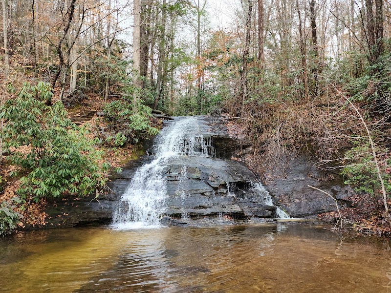
The Cherokee Foothills Scenic Highway extends for 112 miles through the picturesque landscapes of the South Carolina upstate. This scenic byway traces a historic route once used by Cherokee Indians and early settlers. As it meanders along the foothills of the Blue Ridge Mountains, travelers are treated to lush forests, rolling hills, and a series of waterfalls. The region is rich in biodiversity, home to diverse flora and fauna, including migratory birds and native plant species. Several state parks and natural reserves are accessible along the highway, offering ample opportunities for hiking, fishing, picnicking, and camping. Notable parks include Table Rock State Park, featuring the iconic granite dome of Table Rock Mountain, and Jones Gap State Park, known for its waterfalls and challenging trails. The highway is also marked by historical landmarks, providing insight into the area's cultural heritage. Its combination of natural beauty and historical significance makes the Cherokee Foothills Scenic Highway a must-visit destination for outdoor enthusiasts and history buffs alike.
Highlights
Table Rock Mountain and State Park
Jones Gap State Park and its waterfalls
The scenic overlook at Caesars Head
Peachoid, the giant peach-shaped water tower in Gaffney
Notable Natural Features
Table Rock Mountain
A prominent natural landmark featuring a 3,124-foot granite dome and challenging hiking trails.
Caesars Head State Park
Offers stunning panoramic views of the surrounding landscape and a variety of hiking trails.
Peachoid Water Tower
A unique roadside attraction near Gaffney that resembles a giant peach.